
Preparing for GIS data
By Louise
15 October 2022
With less than a month to go before Sea Women Expeditions departs on the 2022 expedition to Arctic Norway I have been putting some time into figuring out how to use modern GIS programs, importing elevation and bathymetry (water depth) data, making maps, and even converting the data into 3D meshes in Blender (for use in Unity later).
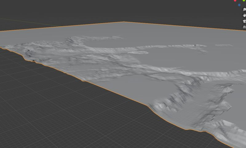
Despite being a geologist (and child of a geography teacher), with lots of experience with maps of various types, I’d already moved on to other things by the time GIS applications really became mainstream, so I’m having to do a lot of learning. Thankfully, the resources online are very high quality, and people are generally very generous with their time - a researcher I came across on LinkedIn, Ian Lochhead, PhD, who has extensive experience in 3D geospatial visualization, gave me some great directions and tips about how to get the terrain models into Blender.
I was also able to find some high-quality (and free) data on the areas of interest courtesy of Geonorge, a repository of Norway mapping data run by the Norwegian Mapping Authority. Unsurprisingly, I’m having a lot of fun playing around with all of this. Hopefully we’ll have a lot of the data/base maps ready to go before we set off, so we can easily plot (and perhaps select in advance) routes and sampling locations. A couple of my teammates on the expedition have GIS experience, so I’m looking forward to seeing what they can do with the data too.